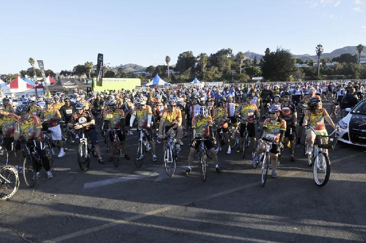
Quick Links
Register
Donate/ePledge
Participant Center

Login to My Participant Center
Username
Password

Forgot your password?

Bike MS Details

Route | Hotels & Camping 
 Visiting VenturaPacket Pickup | Weekend Schedule


We’ve made some changes to this year’s routes to go along with the change in the starting location. The Day 1 longer routes offer the rider satisfying challenges while offering easier but rewarding shorter rides. Day 2 gives the riders a change of pace from the Day 1 routes. They are flat and scenic in a way that is as different from day 1 as the terrain.

Day 1

The Century. Our signature route starts at San Buenaventura State Beach. After a short ride through historic downtown Ventura, the route heads east along the foothills and past citrus orchards toward Santa Paula. Turning north on Hwy 150, the route begins the 8 mile long gentle climb into the beautiful Upper Ojai Valley. The climb is not so difficult that you cannot enjoy the scenery along the way. After a stop for lunch and the quick descent on the Dennison Grade, the route takes riders through Ojai and on toward Lake Casitas. Skirting the north shore of the lake, the route arrives at the major climb of the Tour, Casitas Pass. After a brief, but well deserved rest at the summit, the riders plunge down into the beautiful Casitas Valley before climbing the shorter West Casitas Pass. After a glimpse of the Pacific Ocean, the route make a long descent toward Carpinteria. A gentle ride along the foothills past the flower farms leads the riders into Montecito and then back to Carpinteria. The riders finish the route with a flat ride down the coast to Ventura and the satisfaction of having completed a moderately challenging, but scenic ride.
Route Map | Elevation Profile

The 75 Miler. The 75-mile option follows the Century route through Santa Paula and Ojai to Lake Casitas. Skirting the north shore of the lake, the route arrives at the major climb of the Tour, Casitas Pass. After a brief, but well deserved rest at the summit, the riders plunge down into the beautiful Casitas Valley. The route then heads south along the Ventura River bed, where it joins the Ventura River Bike Path and takes the riders back to the Festival site in Ventura.
Route Map | Elevation Profile


The 60 Miler. The 60 mile option follows the Century route through Santa Paula and Ojai to Lake Casitas. The route then heads south along the Ventura River bed to Foster Park, where it joins the Ventura River Bike Path and takes the riders back to the Festival site in Ventura.
Route Map | Elevation Profile


The 30 Miler. Our 30 mile option is perfect for the activity oriented family riders. Starting at the San Buenaventura State Beach, the route goes through the quiet part of downtown Ventura to the Ventura River Bike Path. The bike path carries no vehicle traffic and follows along the edge of the Ventura River, through wet lands and historic oil fields toward Ojai. After arriving in Ojai and taking a brief rest, the route returns back to Ventura on the bike path past Foster Park.
Route Map | Elevation Profile


The Beginner’s 15 Miler. An ideal ride for those just starting out in their cycling career, the 15 Miler takes the same route as the 30 Miler. The route along the Ventura River Bike Path takes the riders to their rest stop at Foster Park. After resting weary legs, the riders return back along the bike path to the Festival site at Ventura.
Route Map | Elevation Profile


Day 2

The Second 60 Miler. After all the climbing and the inland scenery of the first day, the riders deserve a less challenging ride the second day. So the second day’s mostly flat route takes the riders along the foothills north of Ventura before a short run through Camarillo and then dropping into the agricultural fields of Camarillo and Oxnard. Riders will see bell and jalapeno peppers, artichokes, tomatoes, shallots, cilantro, and lawn turf in the fields as they make their way to Pt. Mugu and Missile Park. The riders will return to the coast through Oxnard and then make a short run up the coast and back into Ventura.
Route Map | Elevation Profile


The Second 30 Miler. The essentially flat 30 mile route follows the 60 mile route from Ventura, through orchards of fruit trees and then into the abundant agricultural fields of Oxnard and Camarillo. The riders join up with their 60-mile counterparts for the return through Oxnard and up the coast into Ventura to enjoy the Finish Line festivities.
Route Map | Elevation Profile


Southern California Bike MS 2009

Achieved:

$1,154,565.01

Goal:

$1,260,000.00

91 percent of goal achieved.


Register Today!
 

Venoco
EMD Serono
Teva Neuroscience
Cynergy Cycles
Motor Tabs
Voler
Bonk Breaker


Event Home | Chapter Home | National Home | Legal Notice / Privacy Policy

National MS Society · Southern California Chapter
2440 S. Sepulveda Blvd. Ste. 115, Los Angeles, CA 90064 · (310) 479-4456 · msevents@cal.nmss.org
© 2009 The National Multiple Sclerosis Society, All Rights Reserved.
All registration fees and donations for this event are nonrefundable.

Powered by Convio